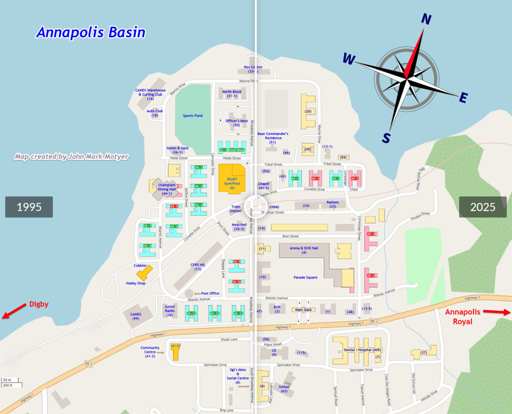
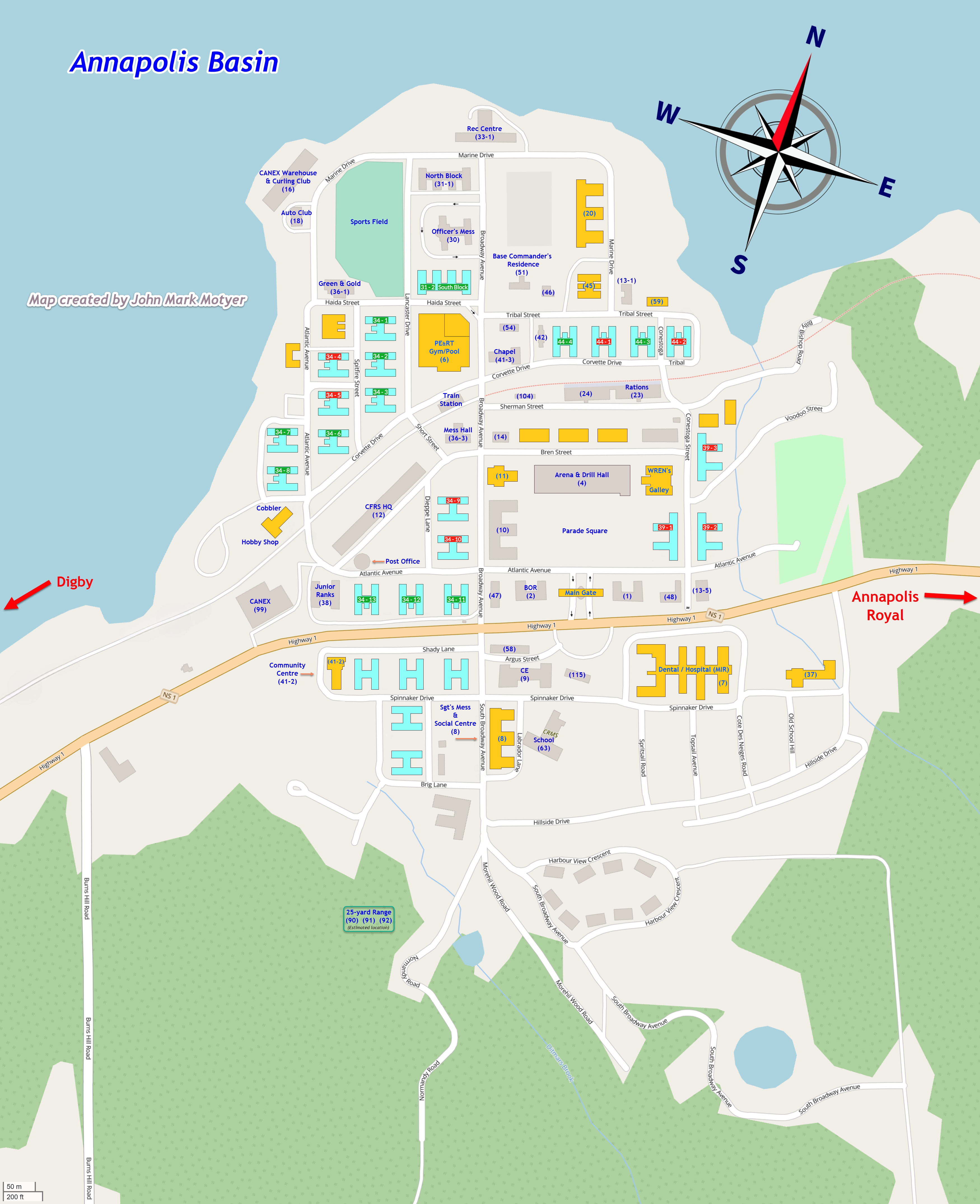
Maps(none of them official)
| I created my maps below from scratch, using small sections of blown-up views from OpenStreetMap (OSM), which I then pasted together, and then rotated 18.6° so that the streets on the map are aligned pretty-much up-down and left-right. |
I then created new barracks (for uniformity) to overlay the existing barracks from the OSM map:
|
| The non-barrack buildings I described in blue. All of my labeling might not be 100% correct, but should be pretty-close. I also added the compass-rose near the top-right corner, and the red direction arrows pointing towards Digby & Annapolis Royal. |
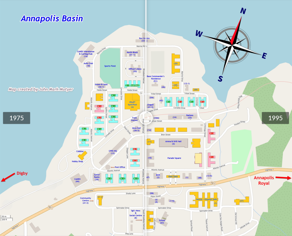
Early 1940s(when the base was created during WW-II)
![Early 1940s(when the base was created during WW-II)]()
All original barracks
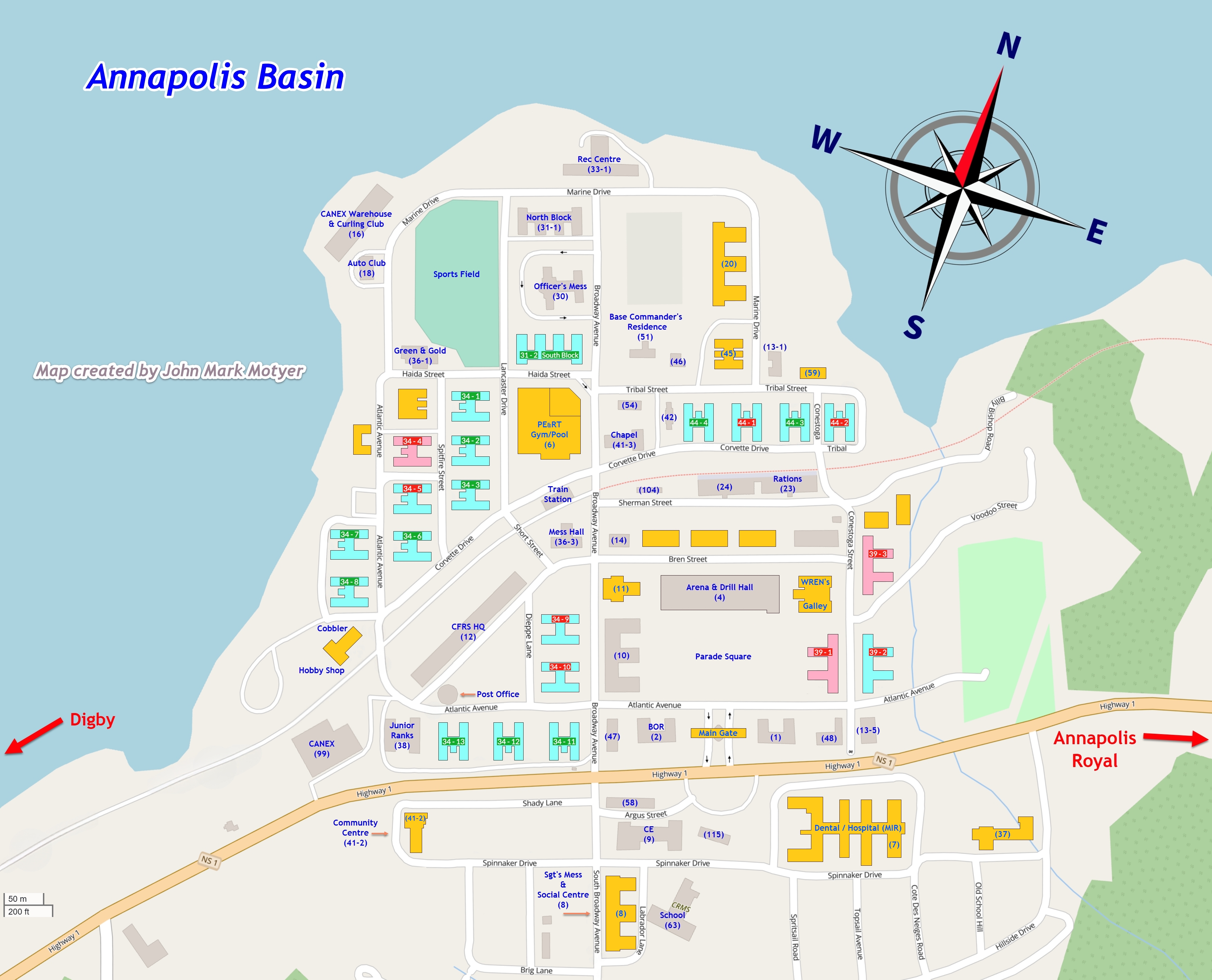
Other buildings1975(the year that I was there... course 7505)
![1975(the year that I was there... course 7505)]()
Original barracks
Barracks demolished by 1975
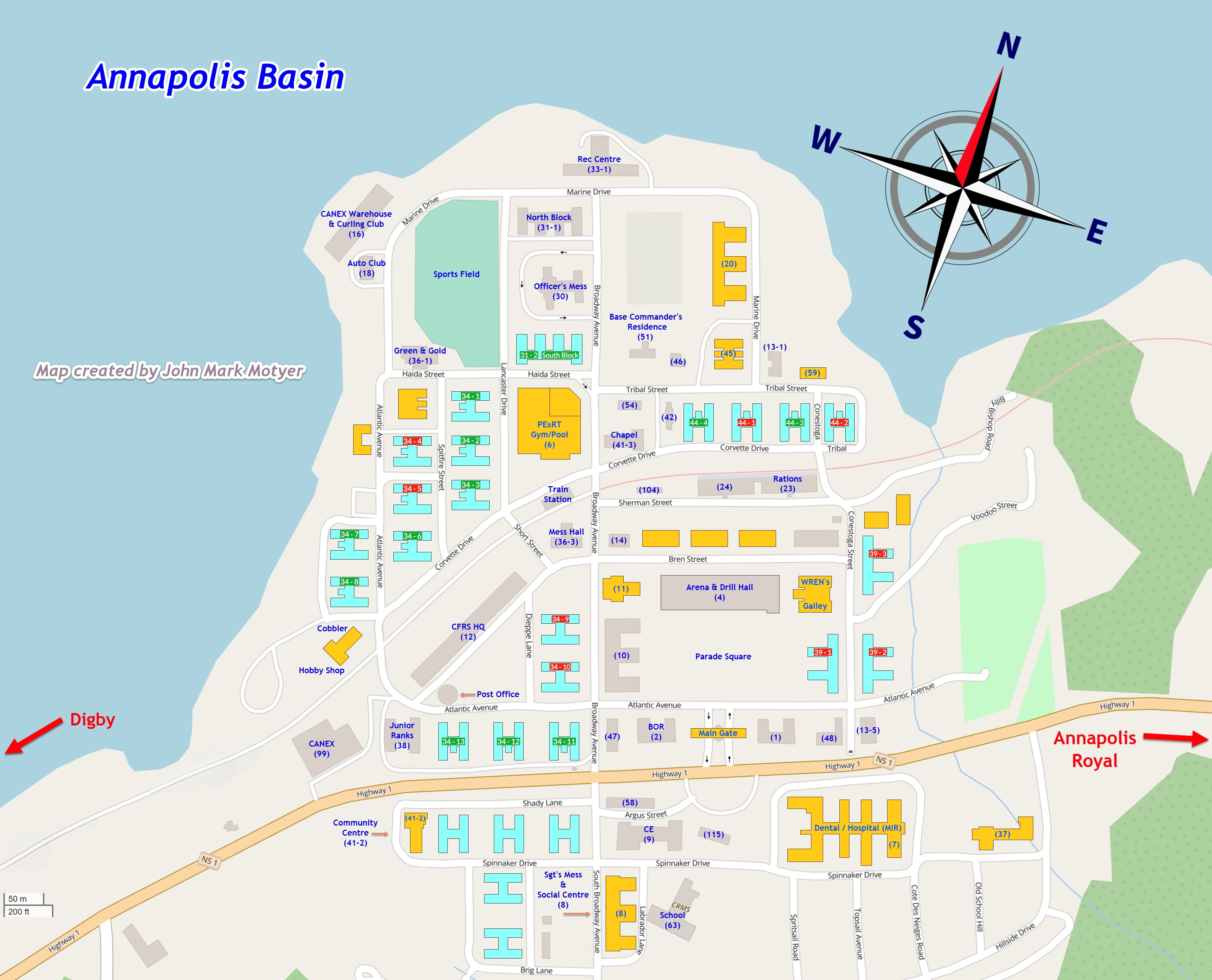
Other buildings that existed in 19751995(the year the base closed & was decommissioned)
![1995(the year the base closed & was decommissioned)]()
Original barracks
Barracks demolished by 1995
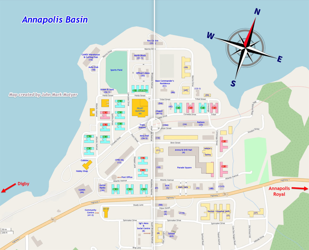
Other buildings demolished by 19952025(as the base looks today, according to Google Maps)
![2025(as the base looks today, according to Google Maps)]()
Original barracks
Barracks demolished by 2025
Other buildings demolished by 20251943 + 2025(compare the base those 2 years)
![1943 + 2025(compare the base those 2 years)]()
1975 + 2025(compare the base those 2 years)
![1975 + 2025(compare the base those 2 years)]()
1995 + 2025(compare the base those 2 years)
![1995 + 2025(compare the base those 2 years)]()
1975 + 1995(compare the base those 2 years)
![1975 + 1995(compare the base those 2 years)]()


